কৃষি উৎপাদকের জন্য বাজেট সুরক্ষা কেন প্রয়োজন?
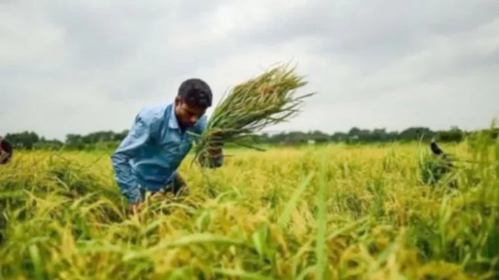
বাংলাদেশের কৃষি এক অনন্য বিস্ময়। জনপ্রতি মাত্র ০.০৫৭ হেক্টর জমির ওপর নির্ভর করেই আমাদের কৃষকেরা ১৮ কোটির অধিক মানুষের খাদ্য জোগান নিশ্চিত করছেন। সীমিত সম্পদ, প্রতিকূল আবহাওয়া এবং নানা অনিশ্চয়তার মধ্যেও তাঁরা থেমে থাকেন না, বরং প্রতিনিয়ত সংগ্রাম করে উৎপাদনের ধারাবাহিকতা বজায় রাখছেন। এই নীরব সংগ্রামই কৃষিকে শক্ত ভিত্তির ওপর দাঁড় করিয়ে রেখেছে। তাই কৃষি শুধু একটি পেশা নয়, এটি মানবসেবা এবং দেশের অর্থনীতি ও সমাজের প্রাণশক্তি। দেশের বিপুল জনগোষ্ঠীর জীবন-জীবিকা কৃষির সঙ্গে সরাসরি জড়িত। খাদ্য নিরাপত্তা, গ্রামীণ কর্মসংস্থান ও সামগ্রিক অর্থনৈতিক স্থিতিশীলতার প্রশ্নে কৃষির গুরুত্ব অনস্বীকার্য। কিন্তু এত গুরুত্বপূর্ণ একটি খাতের মূল চালিকাশক্তি 'কৃষক' নিজেই প্রতিনিয়ত অনিশ্চয়তার মধ্যে বসবাস করছেন।
কৃষকের এই অনিশ্চয়তার উৎসও কম নয়। কখনও প্রাকৃতিক দুর্যোগ, কখনও জলবায়ু পরিবর্তনের প্রভাব, আবার কখনও বাজারের অস্থিরতা কিংবা উৎপাদন ব্যয়ের ঊর্ধ্বগতি—সব মিলিয়ে কৃষকের জীবন হয়ে ওঠে কণ্টকিত। ফলে বছরের পর বছর পরিশ্রম করেও অনেক কৃষক নিজেকে স্বাবলম্বী করতে পারেন না। উল্লেখ্য যে, প্রাকৃতিক দুর্যোগ এখন একটি নিয়মিত ঘটনা—অতিবৃষ্টি, অনাবৃষ্টি, শিলা বৃষ্টি, আকস্মিক বন্যা ও ঝড়ের কারণে ফসলহানি ঘটে, যার দায়ভার শুধু কৃষকের নিতে হয়। এখন প্রশ্ন হচ্ছে, এই ঝুঁকির ভার কৃষক কেন একা বহন করবেন?
বিশ্বের অনেক দেশ এই প্রশ্নের উত্তর খুঁজে পেয়েছে বেশ আগেই। এসব দেশ কৃষিকে সুরক্ষিত রাখতে বাজেট সহায়তা, ভর্তুকি ও কৃষিবীমা ব্যবস্থাকে শক্তিশালী করেছে। উদাহরণস্বরূপ, জাপানে শস্যবীমা বাধ্যতামূলক হওয়ায় প্রাকৃতিক দুর্যোগ, যেমন টাইফুন বা অতিবৃষ্টির কারণে ফসল নষ্ট হলেও কৃষকেরা দ্রুত আর্থিক ক্ষতিপূরণ পেয়ে থাকেন।
অন্যদিকে, চীনে প্রাণিসম্পদের জন্য বিশেষ বীমাব্যবস্থা চালু রয়েছে, যেখানে গবাদিপশুর রোগ, মৃত্যু বা দুর্ঘটনার কারণে ক্ষতি হলে কৃষকেরা সরকারি ও বেসরকারি বীমা কাঠামোর মাধ্যমে ক্ষতিপূরণ পেয়ে থাকেন। বর্তমান বিশ্বে শস্যবীমার ক্ষেত্রে আধুনিক কৌশল প্রয়োগ করা হয়, যা 'ইনডেক্স বেজড বীমা' নামে পরিচিত। এটি এমন এক বীমাব্যবস্থা, যেখানে কৃষকের ব্যক্তিগত ক্ষতি যাচাই না করে নির্দিষ্ট সূচক—যেমন বৃষ্টিপাত, তাপমাত্রা বা ফসল উৎপাদনের গড় মানের ভিত্তিতে ক্ষতিপূরণ দেওয়া হয়।
যদি সূচক নির্ধারিত সীমার বাইরে যায়, তাহলে কৃষক স্বয়ংক্রিয়ভাবে ক্ষতিপূরণ পেয়ে থাকেন। এতে সময় ও প্রশাসনিক জটিলতা কমে এবং স্বচ্ছতা বাড়ে। বাংলাদেশে বেসরকারি ও উন্নয়ন সংস্থার মাধ্যমে এই পদ্ধতি স্বল্প পরিসরে চালু হলেও সরকারিভাবে এখনও চালু করা সম্ভব হয়নি।
প্রকৃতপক্ষে, আমাদের দেশের কৃষকের চাওয়া খুবই সাধারণ ও বাস্তবসম্মত। তাঁরা চান উৎপাদনের জন্য প্রয়োজনীয় উপকরণ সহজে ও সাশ্রয়ীমূল্যে সরবরাহ। বীজ, সার, সেচ, বিদ্যুৎ কিংবা কৃষি যন্ত্রপাতি ও প্রযুক্তি—এসব উপকরণ হাতের নাগালে চান। পাশাপাশি প্রাকৃতিক দুর্যোগে ক্ষতিগ্রস্ত হলে সরকারি সহায়তা বা বীমা সুবিধা যেন পান—সেটির নিশ্চয়তা। এ ছাড়া উৎপাদিত ফসলের ন্যায্যমূল্য হলো তাঁদের প্রাণের দাবি, যাতে তাঁরা সম্মানের সাথে পরিবার নিয়ে জীবনযাপন করতে পারেন।
কিন্তু বাস্তবতা প্রায়ই এই প্রত্যাশার সঙ্গে সঙ্গতিপূর্ণ নয়! বাজারে গিয়ে কৃষক অনেক সময় তাঁর পণ্যের ন্যায্যমূল্য পান না। মধ্যস্বত্বভোগীদের প্রভাব ও দুর্বল বাজার ব্যবস্থার কারণে কৃষকেরা বাধ্য হয়ে কম দামে ফসল বিক্রি করেন। আবার সরকারি ক্রয়ব্যবস্থার কঠোর শর্ত থাকায় অনেক ক্ষুদ্র কৃষক এই সুবিধা থেকে বঞ্চিত হন। ফলে কষ্ট করে ফসল উৎপাদনের পরও মুনাফা অর্জন থেকে বঞ্চিত হন।
এই সংকটের অন্যতম সমাধান হলো কৃষিতে সরকারি বরাদ্দ বৃদ্ধি। কৃষিখাতে বরাদ্দ কিছুটা বাড়লেও তা মোট বাজেটের তুলনায় এখনও সীমিত। গত ৫ বছরে কৃষিতে মোট বাজটের প্রায় ৫ থেকে ৮ শতাংশ হারে বরাদ্দ দেওয়া হয়েছিল। চলতি অর্থবছরে (২০২৫-২৬) এ খাতে বরাদ্দ দেওয়া হয়েছে ৫.৯ শতাংশ, যা পূর্ববর্তী বছরের তুলনায় কম। অন্যদিকে, চলতি বছর কৃষি ভর্তুকি প্রায় ১৭ হাজার কোটি টাকা বরাদ্দ রাখা হলেও তা ২০২২-২৩ ও ২০২৩-২৪ অর্থবছরে (সংশোধিত) বরাদ্দের তুলনায় বেশ কম। তবে নতুন সরকার আগামী অর্থবছর (২০২৬-২৭) কেমন বরাদ্দ দিবেন, তা অনুমান করা ছাড়া এখন অন্যকোনো উপায় নেই। তবে কৃষকের স্বার্থকে সামনে রেখে কিছু পরামর্শ দেওয়া যেতে পারে।
সরকারের নির্বাচনী ইশতেহার অনুযায়ী কৃষকসমাজকে মর্যাদার স্থানে বসাতে হলে কৃষিখাতে বরাদ্দ ও ভর্তুকির পরিমাণ বাড়ানো ছাড়া বিকল্প নেই। আসলে কৃষক কার্ডে যেসকল সেবার কথা বলা হয়েছে, তা নিশ্চিত করতে গেলে কৃষি ও কৃষি-সংশ্লিষ্ট খাতে বাজেট বাড়াতে হবে, একইসাথে ভর্তুকির পরিমাণও বৃদ্ধি করতে হবে। নির্বাচনী ইশতেহার বাস্তবায়নে, কৃষিবীমা, খালখনন ও কৃষি উদ্যোক্তা স্টার্ট-আপের জন্য বাজেটে বিশেষ বরাদ্দ প্রয়োজন।
এরপরও প্রশ্ন থাকে, এই বরাদ্দ ও ভর্তুকির অর্থ কীভাবে সরাসরি কৃষকের কাছে পৌঁছানো যাবে? পর্যালোচনা করলে দেখা যায়, বাজেটের একটি বড় অংশ অনুন্নয়ন খাতে ব্যয় হয়, যা সরাসরি কৃষকের উপকারে আসে না। তাই এখন প্রয়োজন বাজেটের গুণগত পরিবর্তন, যেখানে টেকসই ও লাভজনক কৃষিকে অগ্রাধিকার দেওয়া হবে। একইভাবে কৃষি গবেষণা, সম্প্রসারণ, ন্যায্যমূল্য নিশ্চিতকরণ এবং জলবায়ু সহনশীল কৃষি ব্যবস্থা গড়ে তোলা হবে সবচেয়ে গুরুত্বপূর্ণ। এ লক্ষ্যে কৃষকের সুরক্ষার জন্য স্বল্প ও দীর্ঘমেয়াদী কিছু পদক্ষেপ গ্রহণ করা যেতে পারে:
১. কৃষক কার্ডের আওতায় ঘোষিত সেবাগুলো পর্যায়ক্রমে বাস্তবায়ন করতে হবে। সহজপ্রাপ্য সেবা—যেমন প্রশিক্ষণ, ন্যায্যমূল্যে উপকরণ সরবরাহ, সেচ সুবিধা, আবহাওয়া পূর্বাভাস ও ডিজিটাল পরামর্শ অবশ্যই দ্রুত চালু করা সম্ভব। তবে কৃষিঋণ ও কৃষিবীমার মতো জটিল সেবা ক্ষুদ্র ও প্রান্তিক কৃষকের কাছে পৌঁছানোর জন্য নীতিগত ও প্রাতিষ্ঠানিক প্রস্তুতি প্রয়োজন।
২. যেহেতু সব কৃষকের হাতে কৃষক কার্ড পৌঁছাতে সময় লাগবে, তাই অন্তর্বর্তী সময়ে ভর্তুকি ও প্রণোদনা কার্যক্রম চালু রাখতে হবে। প্রয়োজনে অঞ্চলভিত্তিক স্বল্পমেয়াদী প্রকল্প গ্রহণ করা যেতে পারে, যাতে উৎপাদন ব্যাহত না হয়।
৩. জাতীয় বা বৈশ্বিক সংকট—যেমন বন্যা, ঘূর্ণিঝড়, তেল সংকট বা যুদ্ধ পরিস্থিতিতে কৃষি উৎপাদন সচল রাখতে বাজেটে বিশেষ বরাদ্দ নিশ্চিত করতে হবে।
৪. কৃষিপণ্য সংরক্ষণ ও বাজারজাতকরণ অবকাঠামোর উন্নয়ন করতে হবে। বিশেষ করে পচনশীল পণ্যের জন্য মিনি কোল্ড স্টোরেজ ও আধুনিক গুদাম সুবিধা বাড়ানো জরুরি। প্রয়োজনে পাবলিক-প্রাইভেট পার্টনারশিপকে (পিপিপি) উৎসাহিত করতে হবে।
৫. ভূগর্ভস্থ পানির ওপর নির্ভরতা কমিয়ে খালখননসহ প্রাকৃতিক পানি সংরক্ষণ ও ব্যবহারে সরকারি বিনিয়োগ বাড়াতে হবে।
৬. কৃষির যান্ত্রিকীকরণে বরাদ্দ বৃদ্ধি করতে হবে এবং কৃষিযন্ত্র ক্রয়, পরিচালনা ও রক্ষণাবেক্ষণে প্রশিক্ষণ ও আর্থিক সহায়তা নিশ্চিত করতে হবে। কৃষির যান্ত্রিকীকরণের সুবিধা পেতে সমন্বিত (সমালয়) বা সমবায়ভিত্তিক চাষাবাদকে উৎসাহিত করতে হবে।
পরিশেষে, কৃষি উৎপাদকের জন্য বাজেট সুরক্ষা নিশ্চিত করা কোনো একক খাতের দাবি নয়, বরং এটি একটি জাতীয় দাবি। কৃষক সুরক্ষিত থাকলে খাদ্য নিরাপত্তা নিশ্চিত হবে, গ্রামীণ অর্থনীতি শক্তিশালী হবে এবং দেশের উন্নয়ন আরও টেকসই হবে। সরকার এটি যত দ্রুত অনুধাবন করবে, ততই দেশের কল্যাণ সাধিত হবে।